
A felt earthquake of magnitude 4.7 occurred SSW of Bukavu on 15 Sept 2017 at 17:45:46 UTC.
Following the main event, aftershock activity typical for such an event occurred and may still continue. The largest recorded aftershock (magnitude 4.1) occurred on 16 Sept 2017 at 04:44:41 UTC (See Fig).
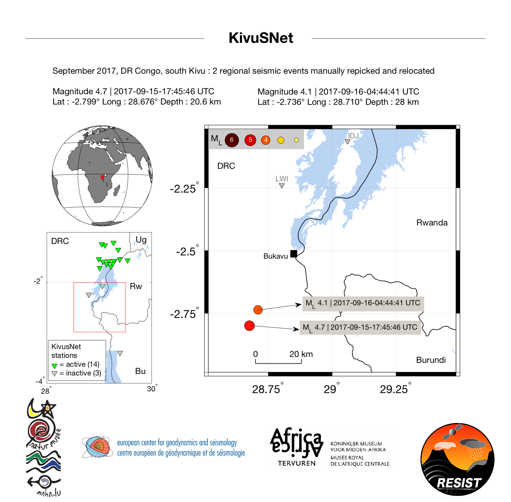
Despite the apparent time proximity with other events in the South Kivu region (e.g. August 2015 and September 2016; see
https://www.virunga-volcanoes.org/current-activity/activity-reports/), the occurrence of this event does not suggest any increase in the seismic activity. The location and occurrence rate of earthquakes of that magnitude range are in line with historical records and the recent seismicity of this area. See for instance Fig 8 in Delvaux et al. (2016) or Fig 5 in Oth et al. (2016). They are a normal consequence of the regular opening of that portion of the rift.
https://www.virunga-volcanoes.org/current-activity/activity-reports/), the occurrence of this event does not suggest any increase in the seismic activity. The location and occurrence rate of earthquakes of that magnitude range are in line with historical records and the recent seismicity of this area. See for instance Fig 8 in Delvaux et al. (2016) or Fig 5 in Oth et al. (2016). They are a normal consequence of the regular opening of that portion of the rift.
The Sept 15-16 events have caused no noticeable influence on the volcanic activity in the Virunga Volcanic Province.
These results were obtained using KivuSnet seismic data (Oth el al., 2016) and 4 international stations located within a 1000 km range. These events were reviewed by a seismologist.
References:
– Delvaux, D., et al. (2016), Seismic hazard assessment of the Kivu rift segment based on a new seismotectonic zonation model (Western Branch, East African Rift system), Journal of African Earth Sciences, doi:10.1016/j.jafrearsci.2016.10.004
– Oth et al. (2016), KivuSNet: The First Dense Broadband Seismic Network for the Kivu Rift Region (Western Branch of East African Rift), Seismological Research Letters, doi:10.1785/0220160147/-/DC1